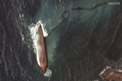
A mushrooming oil spill in waters near Trinidad and Tobago was caused by an overturned and abandoned barge, early investigations have found.
Satellite images provided by Maxar Technologies show the stricken vessel, reportedly carrying 35,000 barrels of oil, with fuel spilling from it on February 15.
The slick has reached about 144km into the Caribbean Sea, The Caribbean country's Prime Minister Keith Rowley described the incident as a "national emergency".
- With Reuters
Topics:
The Trinidad and Tobago Coast Guard, with help from regional agencies and satellite images, determined that the barge and a tug boat were travelling from Panama to the South American nation of Guyana.
Officials have said it was not clear if anybody was aboard the barge when it overturned and apparently began to sink off Tobago's coast.
They are still searching for the tug boat and its owner.
Authorities installed booms - floating barriers - to prevent the spill from spreading to other areas, CNN reports.
Officials have also dispatched divers to try to plug the leak but have not been successful.
The spill took place during carnival season, one of Trinidad and Tobago's biggest tourist attractions.
It has forced several beachside golf courses and holiday resorts to close temporarily.
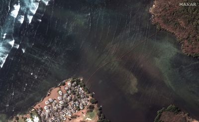
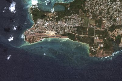
Swipe through to see more satellite images.
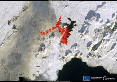
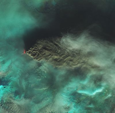
One of the European Union's Copernicus satellites captured this image of the Fagradalsfjall volcanic eruption in Iceland, on February 8.
The image was taken less than 10 hours after the eruption began.
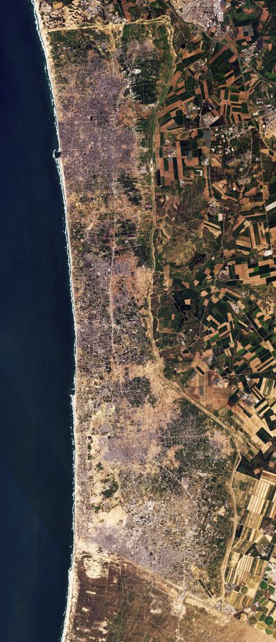
New satellite photos from Planet Labs PBC shows demolition along a one kilometre-deep path on the Gaza Strip's border with Israel, according an analysis by The Associated Press and expert reports.
The destruction comes as Israel has said it wants to establish a buffer zone there, over international objections, further tearing away at land the Palestinians want for a state.
The demolition along the path represents only a fragment of the wider damage from the Israel-Hamas war seen in Gaza, which one assessment suggests has damaged or destroyed half of all the buildings within the coastal enclave.
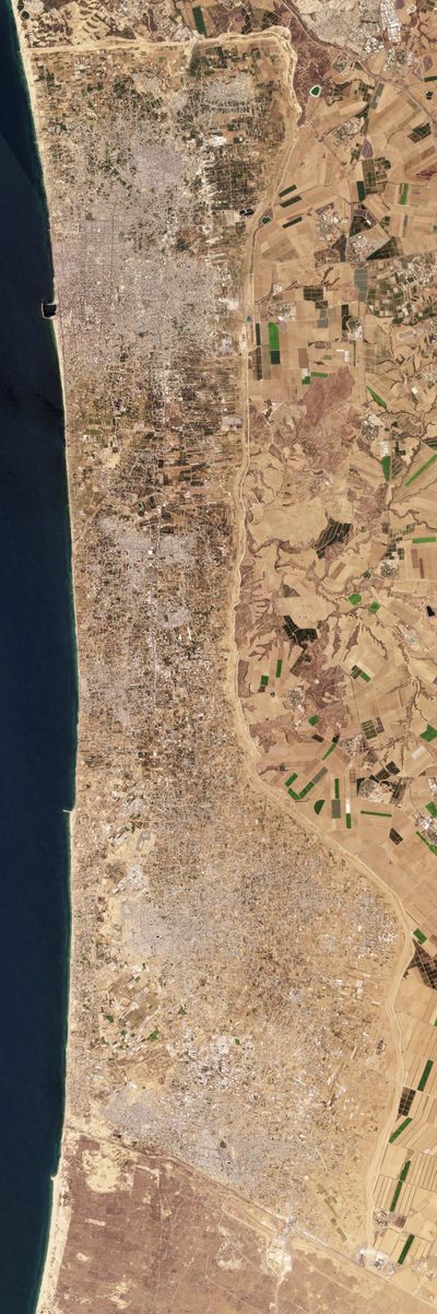
This image shows the same area of the Gaza Strip last August, two months before Hamas launched a surprise attack on Israel.
Israeli leaders have signalled that they would like to establish a buffer zone as a defensive measure, which they contend could prevent a repeat of the cross-border attack by Hamas that triggered the nearly four-month-old war. That's despite U.S. warnings not to shrink Gaza's territory.
An Israeli government official, speaking on condition of anonymity, said a "temporary security buffer zone" is under construction.
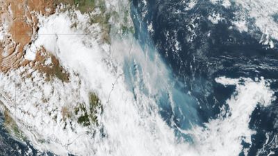
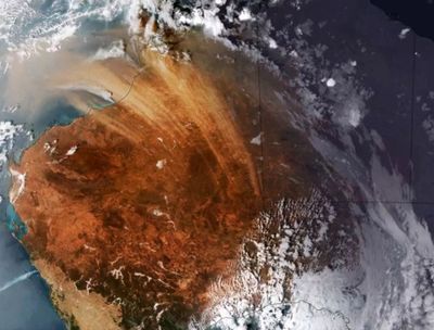
Smoke generated from a large bushfire burning in northern New South Wales can be seen from space.
Satellite images show the smoke plume stretching around 1500km across the Tasman Sea.
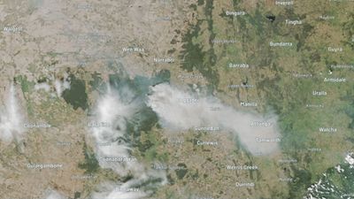
Satellites captured the smoke billowing from the fire, which has burnt close to 130,000 hectares.
The smoke has even reached towns as far as Coonamble, Tamworth, Dubbo, Newcastle and Sydney.
A huge dust storm spanning 1800km tracking across Western Australia has been captured in satellite images.
The phenomenon was formed on Sunday, December 10 by strong and gusty southerly winds sweeping through the Kimberley region and kicking up desert dust.
The storm was so big it was spotted and recorded in images from Japan's Himawari weather satellite.
Airborne particles of dust were visible over the waters of the Indian Ocean off WA's north-west coast.
The tallest volcano in Europe and Asia has violently erupted, sending a cloud of ash and dust into the air.
NASA's Aqua satellite captured the moment lava and ash from the Klyuchevskoy volcano in Russia rose to 12 kilometres above sea level.
The volcano itself has been continually erupting since mid-June.
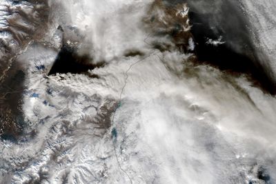
The smoke and ash even prompted authorities to close schools in nearby towns.
Planes were also ground after the aviation colour code was elevated to red.
The Klyuchevskoy volcano is located along the Pacific Ring of Fire, which is home to more than 300 volcanoes.
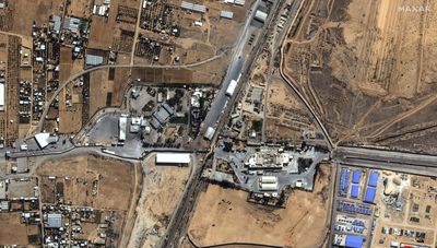
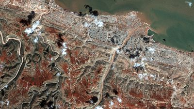
This is the most watched border crossing in the world.
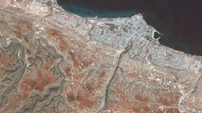
This image provided by Maxar Technologies, shows the Rafah Border crossing between Gaza, and Egypt.
At Gaza's Rafah crossing into Egypt, announcement of an agreement to briefly open the closed crossing to allow foreigners to escape brought hopeful crowds to the gates Saturday. But any deal appeared to have fallen through, with the crossing yet to open by nightfall.
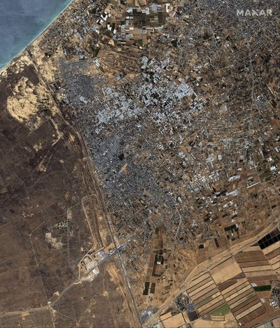
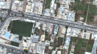
This image provided by Maxar Technologies, shows an overview of the Palestinian city of Rafah and south Gaza Strip, Sunday, Oct. 15, 2023.
Strikes hit the cities of Rafah, where 27 were reported killed, and Khan Younis, where 30 were reported killed, according to Bassem Naim, a senior Hamas official.
The Israeli military said it was targeting Hamas hideouts, infrastructure and command centers.
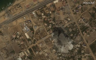
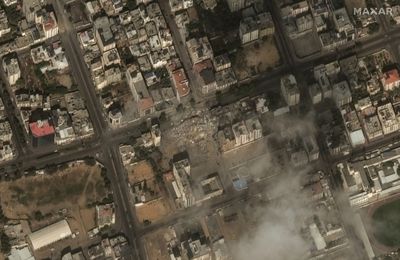
This image provided by Maxar Technologies, shows an explosion from an airstrike in Gaza City, Tuesday Oct. 10, 2023.
The Health Ministry in Gaza said that about 3,000 had been killed and more than 12,500 wounded.
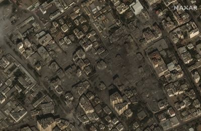
This image provided by Maxar Technologies, shows destroyed residential buildings in Gaza City, Tuesday Oct. 10, 2023.
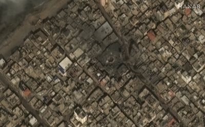
This image provided by Maxar Technologies, shows the destroyed Al-Gharbi West Mosque in Gaza, Tuesday Oct. 10, 2023.
This image provided by Maxar Technologies, shows the destroyed Watan Tower in Gaza, Tuesday Oct. 10, 2023.
Satellite images from Maxar Technologies have shown the devastation floods caused by Mediterranean Storm Daniel have wreaked on eastern Libya, in particular the city of Derna. A neighbourhood of the city is shown here on July 1.
Over 5300 people have been killed in the floods so far.
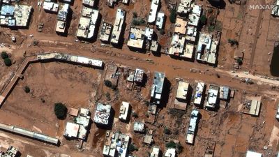
And this is the same neighbourhood on September 13, after two damns above the city collapsed, flooding the streets.
The death toll from the floods has topped 5000. Here is a port area of Derna pictured in July.
And the same ravaged area on September 13.