
Your web browser is no longer supported. To improve your experience update it here
SYDNEY Weather
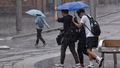
19Showers
Feels like20
Max26
Min20
- Rain chance: 90%
- Wind: W 11km/h
- Rainfall: 17.8mm
- Humidity: 95%
- UV Alert: Very High
Hourly forecast
Weekly weather
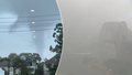
SYDNEY rain radar map
13:15 AEDT13:20 AEDT13:25 AEDT13:30 AEDT13:35 AEDT13:40 AEDT
12:30 AEDT12:40 AEDT12:50 AEDT13:00 AEDT13:10 AEDT13:20 AEDT
View New South Wales satellite
View national synoptic
Weather warnings
Detailed Severe Thunderstorm Warning (Heavy Rainfall) for parts of Wollondilly/Wingecarribee, Greater Wollongong and Sydney areas
Australian Government Bureau of Meteorology New South Wales TOP PRIORITY FOR IMMEDIATE BROADCAST Detailed Severe Thunderstorm Warning for Heavy Rainfall for parts of Wollondilly/Wingecarribee, Greater Wollongong and Sydney areas. Issued at 1:37 pm Tuesday, 20 February 2024. HEAVY RAINFALL for the following areas: Sydney, Wollondilly/Wingecarribee and Greater Wollongong The Bureau of Meteorology warns that, at 1:10 pm, a severe thunderstorm likely to produce heavy rainfall that may lead to flash flooding was detected near waters off Stanwell Park, Helensburgh, Stanwell Park and waters off Thirroul. This thunderstorm is moving towards the west. It is forecast to affect Bulli, Darkes Forest and Thirroul by 1:25 pm and Lake Cataract by 1:40 pm. The State Emergency Service advises that people should: * Keep clear of creeks and storm drains. * Don't walk, ride your bike or drive through flood water. * If you are trapped by flash flooding, seek refuge in the highest available place and ring 000 if you need rescue. * Unplug computers and appliances. * Avoid using the phone during the storm. * Stay indoors away from windows, and keep children and pets indoors as well. * For emergency help in floods and storms, ring the SES (NSW and ACT) on 132 500. A more general severe thunderstorm warning is also current for parts of the Metropolitan and Illawarra districts. The next warning is due to be issued by 2:10 pm. Warnings are also available through TV and Radio broadcasts, the Bureau's website at www.bom.gov.au or call 1300 659 210. The Bureau and State Emergency Service would appreciate warnings being broadcast regularly.Severe Thunderstorm Warning (Heavy Rainfall) for parts of Metropolitan and Illawarra
Australian Government Bureau of Meteorology New South Wales TOP PRIORITY FOR IMMEDIATE BROADCAST Severe Thunderstorm Warning for Heavy Rainfall for parts of Metropolitan and Illawarra Forecast Districts. Issued at 1:33 pm Tuesday, 20 February 2024. Heavy rainfall near Woolongong and Southern Sydney. Weather Situation a coastal trough and onshore flow is resulting in slow-moving showers and thunderstorms into the Sydney and Illawarra coasts this afternoon. HEAVY RAINFALL for the following areas: Metropolitan and Illawarra Severe thunderstorms are likely to produce heavy rainfall that may lead to flash flooding in the warning area over the next several hours. Locations which may be affected include Wollongong, Campbelltown, Bulli, Port Kembla, Albion Park and Kiama. The State Emergency Service advises that people should: * Keep clear of creeks and storm drains. * Don't walk, ride your bike or drive through flood water. * If you are trapped by flash flooding, seek refuge in the highest available place and ring 000 if you need rescue. * Be aware that run-off from rainfall in fire affected areas may behave differently and be more rapid. It may also contain debris such as ash, soil, trees and rocks. * After bushfires, heavy rain and the loss of foliage can make the ground soft and heavy, leading to a greater chance of landslides. * Unplug computers and appliances. * Avoid using the phone during the storm. * Stay indoors away from windows, and keep children and pets indoors as well. * Stay vigilant and monitor conditions. Note that the landscape may have changed following bushfires. * For emergency help in floods and storms, ring the SES (NSW and ACT) on 132 500. The next warning is due to be issued by 4:35 pm. Warnings are also available through TV and Radio broadcasts, the Bureau's website at www.bom.gov.au or call 1300 659 210. The Bureau and State Emergency Service would appreciate warnings being broadcast regularly.
National weather
Weather Articles
Data supplied byWeather Zone